


SOME AGRICULTURAL APPLICATIONS WITH UNMANNED AERIAL VEHICLES
Recently, UAVs used in agriculture have started to provide spatial variable applications of many agricultural activities such as the determination of plant agronomic characteristics, plant disease detection, spraying applications, crop yield estimation, phenological observations, irrigation and fertilization programs, and crop mapping. By UAVs, 2D or 3D maps of farmland can provide useful information about the area of farmland, soil conditions, and crop condition in developing models and determining their productivity. For this reason, mapping research continues to attract attention recently. Guillén-Climent et al. (2014) obtained high-resolution maps identifying regional variations in radiation detection using UAV images. These maps were also used to provide agronomic control of the regions and to separate fruit quality areas.
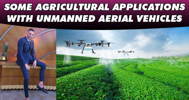
UAVs can reduce pesticide use and enable maximum efficiency compared to pesticides with rapid and wide-area use (Pyo, 2006; Luck et al., 2010). UAV studies provide to reduce the need for labor. In 2016, they worked with UAVs to determine the optimum level by spraying pesticides from various heights in citrus farms. However, as a result of remaining in an unsprayed area during spraying or applying pesticides to the same place one after the other, or application to non-target parts of the product, may cause effects that may cause a decrease in product yield. At the same time, meteorological conditions such as the direction and strength of the current wind during spraying may adversely affect the application. Faiçal et al. In their work in 2014, they developed an algorithm to eliminate these negative effects. According to these authors, the UAV receives the data from the wireless sensor network on the ground, and as a result of this information, it applies pesticides and fertilizer to the crop according to the wind strength and direction. Thus, overuse of these inputs is prevented.

It is possible to carry out plant planting works more effectively and efficiently using UAVs. For example, it seems appropriate to work with UAVs in large and irregular paddy fields (Salaan et al., 2019). A system is used to disperse seeds and plant nutrients during planting. Although the use of unmanned aerial vehicles for cultivation is still under development, it is expected that more efficient results will be obtained thanks to the UAVs equipped with image recognition technology and optimized cultivation strategies.
Precision agriculture determines and uses the most appropriate management strategy to access data on soil properties, land morphology, and crop growth. The most important information for crop cultivation is nutritional status, weed infestation, disease, and water management. The application of nitrogen fertilizer to field crops is of great importance as it determines the growth, vitality, color, and yield of the plant. It is possible to measure the nitrogen availability of the product with optical instruments. Since most leaf nitrogen is found in chlorophyll molecules, there is a strong relationship between leaf nitrogen and leaf chlorophyll content, for which the nitrogen status of the crop can be estimated by measuring the nitrogen in the leaves. For this reason, using high-resolution sensors that can monitor the nitrogen content of the product during the growing season can provide useful information to ensure that the producers reach their production targets (Agüera et al., 2011). Determining the actual nutrient requirement of the plant with the data obtained from the images obtained from the UAVs is more important both in terms of being more economical and in terms of environmental conditions.

Some geometric features of existing trees in agricultural areas, such as canopy areas, heights, and crown width of trees, help to obtain important information about plantation and crop production. However, it is very difficult to detect these factors, and causes a lot of time. For this reason, researchers used the technique of creating Digital Surface Models with Unmanned Aerial Vehicle (UAV) technology and object-based image analysis techniques to calculate the 3D geometric properties of individual trees and tree rows (Torres-Sánchez et al., 2015). According to the results obtained, the results obtained with UAV technology have achieved successful results in both single tree and tree-row afforestation and while they have determined an accuracy of approximately 97% in area measurement, they have reported very small deviations in tree heights and crown widths compared to in-field estimations.
UAVs are suitable tools for environmentally sensitive approaches, especially targeted in smart agriculture applications. Thanks to this technology, while the dependency on people and labor has decreased, more accurate, faster, low-cost, less pesticide use and more efficient product acquisition have begun to be achieved.
Depending on the technological developments in UAVs, high resolution imaging of hundreds of decares of agricultural land has begun to be made, with increases in battery capacities, prolongation of flight times and additional flights. In addition, with the lightening and development of cameras mounted on UAVs, their usage rates have increased and gained momentum. In addition to all these advantages, legal conditions, restrictions and security issues in flight are also an obstacle to this spread.
Dr.Yaşam Ayavefe

REFERENCES
Guillén-Climent, M.L., Zarco-Tejada, P.J., Berni, J.A., North, P.R. and Villalobos, F.J. (2012). Mapping radiation interception in row-structured orchards using 3D simulation and high-resolution airborne imagery acquired from a UAV, Precis. Agricult.,13 (4): 473–500.
Agüera, F., Carvajal, F., Pérez, M. (2011). Measuring sunflower nitrogen status from an unmanned aerial vehicle-based system and an on the ground device. International Archives of the Photogrammetry, Remote Sensing and Spatial Information Sciences, (s. 33-37). Zurich.
Pyo, S. (2006). Actual state of pesticide management and rate of complaints of prevalency subjective symptom in some farmer,’’ M.S. thesis, Occupational Health Graduate School Public Health, Yonsei Univ., Seoul, South Korea.
Salaan, C.J., Tadakuma, K., Okada, Y., Sakai, Y., Ohno, K. and Tadokoro, S. (2019). Development and experimental validation of aerial vehicle with passive rotating shell on each rotor. IEEE Robot. Autom. Lett., vol. 4, no. 3, pp. 2568–2575, Jul.
Torres-Sánchez, J., Peña, J.M., Castro, A.I. de and López-Granados, F. (2014). Multi-temporal mapping of the vegetation fraction in early-season wheat fields using images from UAV. Comput. Electron. Agricult., 103: 104–113.
Luck, J., Pitla, S.K., Shearer, S.A, Mueller, T.G., Dillon, C.R., Fulton, J.P. and Higgins S.F. (2010). Potential for pesticide and nutrient savings via map-based automatic boom section control of spray nozzles. Comput. Electron. Agricult., 70 (1): 19–26.


-
 Arıklı, 23 Nisan Ulusal Egemenlik ve Çocuk Bayramı dolayısıyla mesaj yayımladı..
-
 Tosunoğlu: Vekil olmaktan mutlu değilim
-
 Dünyada israf edilen gıdalar, yetersiz beslenen insanların 2 katından fazlasına ..
-
 Oğuz: 3 ayda bin 462 kişiyi ülkeye almadık, 827 kişiyi deport ettik
-
 YÖDAK’ın Araştırılması Komitesi Başkanı Hasan Küçük oldu
-
 Stefanu’dan Hristodulidis’e sert eleştiri: Kıbrıs sorununda izlediği çizgi esasl..
-
 BAHÇELİ’DE YOL YENİLEME ÇALIŞMALARI BAŞLADI