


SUSTAINABLE AGRICULTURE AND THE USE OF UNMANNED AERIAL VEHICLES
Due to the rapid spread of commercial UAVs, one of the innovative technologies, in the world and being a new sector with rapidly changing rules, legal regulatory laws and regulations are enacted around the world. Civilian applications of UAVs have increased significantly in recent years due to greater availability and smaller size of sensors, GPS, inertial measurement units, and other equipment. This technology is used by UAVs for infrastructure maintenance, agriculture, mining, emergency response, cargo delivery, etc. It provides a range of applications ranging from real sizes under meters and autonomously to inspection, mapping, research, and transportation (Sebbane, 2018). As drone use increases, countries include drones in their aviation regulatory frameworks, and these regulations are constantly being reassessed. Various regulatory standards are applied for all types of UAVs in the world. National drone regulations generally tend to have the following few elements:
- Depending on drone weight, flight altitude, and population density, etc. restricted to flight zones,
- UAV pilot license in case of professional use,
- Drone recording in case of professional use,
- Radio wave regulation,
- Insurance in case of professional use.
Although agriculture is an important sector, it is a necessary and strategic activity for the continuity of life. Due to the rapid increase in the world population and urbanization, agricultural areas are decreasing, and thus natural resources such as agricultural land and water per capita decrease. The primary goal of agricultural production is to provide economic, sustainable, and productive management in plant and animal production. For this purpose, by using technology in various subjects in agriculture, alternative solutions are developed for facilitating agricultural operations and problems that need solutions or improvement.. As a result of migration from villages to cities, the increase in the elderly population in the village can be counted. For this reason, it has become necessary to increase productivity by using technology and genetic methods in agricultural production. Increasing productivity and product quality in agricultural production depends on the good follow-up of the development process of the plants and the timely implementation of the necessary applications. High-resolution photos are captured with sensors and cameras placed on drones, which have a simple technical structure and easy use, and provide farmers with the opportunity to plan agricultural activities by creating 3D maps. Thus, up-to-date data on agricultural activities can be collected and production efficiency can be achieved.
Ore et al. (2020), a drone equipped with SAR was used in the study, in which a model was created and the growth map was prepared for the growth prediction of the maize plant. The SAR provided information on terrain altitude displacement between two flights at different times following the same flight path. In the data collection process with SAR, the researchers first mounted triangular reflectors in the test area for ground and radiometric calibration. Then, they placed the GNSS ground station close to the starting position of the drone and started GNSS recording, and selected a circular flight model to generate the growth maps. After the radar was turned on, the drone was flown on different dates by following the same circular flight route from a height of 120 m. In this way, projection images obtained from circular flights were processed with a back projection algorithm using 30x30 cm sampling, and a plant growth map was produced.
Gago et al. (2015) for water stress management in vineyard areas, various reflectance indices such as NDVI, TCARI/OSAVI (Transformed Chlorophyll Absorption in Normalized Reflection Index/Optimized Soil-Adjusted Vegetation Index), and PRInorm (Photochemical Reflection Index) were obtained from a vineyard by drone. has been done. It has been reported that these reflectance indices show positive correlations with water stress indicators such as water potential and stomatal conductivity. Researchers have reported that drought encourages the closure of stomata, so the plant's transpiration and cooling by evaporation decrease while leaf temperature increases. They also reported that thermal images can be used to detect water stress in such cases.
In recent years, the popularity of drones and the increase in their use in agriculture attracts the attention of those from different disciplines other than agriculture.
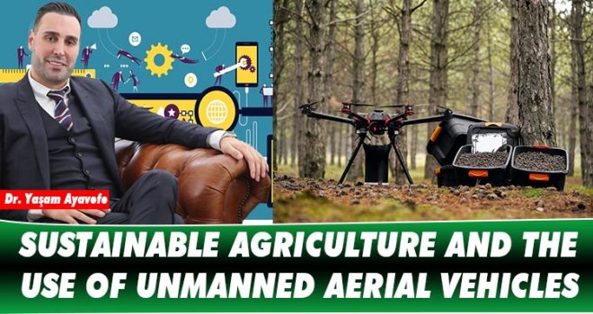
The lack of some technical information about agricultural practices causes some false information about the use of drones in agriculture or ineffective uses. For this reason, it is necessary to have information about the agricultural technical infrastructure in order to carry out effective agricultural practices with drone. In addition, our level of domestically producing technology and providing service for drone development and field applications is not yet at the desired level. However, there is a high sales potential in this field in the national and international market. For this purpose, R&D projects and branding investments of young entrepreneurs and researchers should be encouraged and supported. Today, the increasing technical possibilities and the variety of equipment required for drone design, and easy access to these equipment, ensure the further development and popularity of drones. In addition, the increase in interest and demand for drones provides the emergence of new brands and models on the market. Thus, a new market opportunity and infrastructure is created in the agricultural field. One of the pioneers in this field is Dr. Yaşam AYAVEFE and its team. The team that steers the sector with its R&D studies is the representative of the clean and sustainable technology approach.
Dr.YAŞAM AYAVEFE


-
 Dünyada israf edilen gıdalar, yetersiz beslenen insanların 2 katından fazlasına ..
-
 Arıklı, 23 Nisan Ulusal Egemenlik ve Çocuk Bayramı dolayısıyla mesaj yayımladı..
-
 Tosunoğlu: Vekil olmaktan mutlu değilim
-
 Oğuz: 3 ayda bin 462 kişiyi ülkeye almadık, 827 kişiyi deport ettik
-
 YÖDAK’ın Araştırılması Komitesi Başkanı Hasan Küçük oldu
-
 Stefanu’dan Hristodulidis’e sert eleştiri: Kıbrıs sorununda izlediği çizgi esasl..
-
 BAHÇELİ’DE YOL YENİLEME ÇALIŞMALARI BAŞLADI