


USING UNMANNED AERIAL VEHICLES IN FOREST MANAGEMENT
In a world, where life continues to be maintained, stubble fires that are burned intentionally or imprudently, or unconsciously, can turn into large-scale fires for a very long time, in which the intervention is insufficient. As a result of the loss of control of the burned stubble fire, hectares of areas in various land types can be damaged and become unusable. When examined in terms of the area where the fires took place, it is not possible to reach the fire for a very long time and cannot be intervened if there is no transportation from the land due to geographical conditions and if the air response units are not stationed at the points close to the emergency response. The availability of high-tech vehicles such as firefighting drones, which can reach the area before the fire department and prevent the spread of the fire, in the critical period until the intervention of the reported or detected fire, creates a vehicle selection problem. The tool selection problem is an extremely important issue in terms of performing an existing task as intended. It is necessary to choose the best drone that will not force the buyer institutions financially and will gain the satisfaction of the users. Therefore, it is a very important issue for consumers to make the right decision.
Forestry works are activities carried out in a wide range of long-term and difficult conditions. There is an important need for information in the realization of these activities, which consist of planning, decision-making, and management stages. In the past, images obtained by satellite and aerial vehicles have been widely used in forestry by converting them into useful information. Due to various meteorological adverse conditions, it is not possible to reach or obtain information at any time. Unmanned aerial vehicles (UAVs) offer useful opportunities because of the practical ease of application in this field.
Ease of application, fast turnaround, and ease of use, especially according to work, can be seen as an indication that UAV-based vehicles will become more widespread in the future with increasing momentum. From the past to the present, UAVs have been the subject of study, especially in the international arena and in various environments. The first starting points of these are generally seen as the use of UAVs in sectors, UAV coordination software, and coding (Vincent and Rubin, 2004). Today, computer science, engineering, earth sciences, agriculture, forestry, etc. It has become a tool that is frequently used in studies in journals publishing in various sectors. Drones and similar vehicles are used in various fields within forestry activities. Some of these are Mapping of forests (Tang and Shao, 2015), Forest inventory studies (Wallace et al., 2012), 3D map making (Nex and Remondino, 2014), Combating forest fires (Zhao et al., 2012), combating forest pests (Dash et al., 2018), and wildlife monitoring (Linchant et al., 2015), etc. can be sorted.
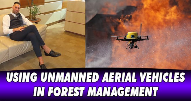
In this respect, Dr. Yaşam AYAVEFE and his team have started to work innovatively for the use of unmanned aerial vehicles in the prevention, early detection, and extinguishment of forest fires. Forest fires are an important problem because they affect not only the green area in which they started but also all living things living in this area. Solving this problem is one of the most important human duties.
It is expected that similar studies will increase in the field of forestry. The use of UAVs has great potential to be used effectively in the decision-making process and planning stages in almost all fields of activity within the forestry sector. With the use of UAVs, problems in forest management can be solved more quickly and reliably by being supported by various software for the development of the forestry sector. Since UAV (drone) vehicles with practical use will take place in the forestry sector in the future, it is important to train the personnel who will use these vehicles.
Forests are important ecosystems for the continuity of life. In recent years, climate change and forest losses due to natural or human causes have created concerns about the biodiversity crisis and the lack of ecosystem services. Forest fires damage forest dynamics by disrupting the carbon cycle. Decreased forest areas as a result of forest fires are one of the main causes of global warming.
In order to minimize forest and city fires, which cause great ecological and economic losses, it is necessary to understand the causes of fires and then take precautions. At the point where the fire started, it is important to detect and intervene early, as the fire tends to start at a certain point and spread to more areas. With the developing technology, unmanned aerial vehicles are used to detect forest or city fires early. Today, the use of unmanned aerial vehicles has increased in daily life as well as in the military field. Unmanned aerial vehicles have advantages such as flexible usage area, fast and high maneuverability, and better resolution in monitoring small areas compared to satellite images. Unmanned aerial vehicles are used in many different fields such as photography, agriculture, surveillance and transportation, as well as for fire tracking and extinguishing purposes. With the expansion of the usage areas of unmanned aerial vehicles, their accessibility has increased. With the increase in the use of unmanned aerial vehicles, image processing and artificial intelligence applications are frequently used in integration with the unmanned aerial vehicle.
Dr.YAŞAM AYAVEFE

REFERENCES
Vincent, P., Rubin, I. 2004. A framework and analysis for cooperative search using UAV swarms. In Proceedings of the 2004 ACM symposium on Applied computing (pp. 79-86). ACM.
Wallace, L., Lucieer, A., Watson, C., Turner, D. 2012. Development of a UAV-LiDAR system with application to forest inventory. Remote Sensing, 4(6), 1519-1543.
Zhao, Y., Ma, J., Li, X., Zhang, J. 2018. Saliency detection and deep learning-based wildfire identification in UAV imagery. Sensors, 18(3), 712.
Dash, J., Pearse, G., Watt, M. 2018. UAV multispectral imagery can complement satellite data for monitoring forest health. Remote Sensing, 10(8), 1216.
Tang, L., Shao, G. 2015. Drone remote sensing for forestry research and practices. Journal of Forestry Research, 26(4), 791-797.
Linchant, J., Lisein, J., Semeki, J., Lejeune, P., Vermeulen, C. 2015. Are unmanned aircraft systems (UAS s) the future of wildlife monitoring? A review of accomplishments and challenges. Mammal Review, 45(4), 239-252.


-
 Dünyada israf edilen gıdalar, yetersiz beslenen insanların 2 katından fazlasına ..
-
 Arıklı, 23 Nisan Ulusal Egemenlik ve Çocuk Bayramı dolayısıyla mesaj yayımladı..
-
 Tosunoğlu: Vekil olmaktan mutlu değilim
-
 Oğuz: 3 ayda bin 462 kişiyi ülkeye almadık, 827 kişiyi deport ettik
-
 YÖDAK’ın Araştırılması Komitesi Başkanı Hasan Küçük oldu
-
 Stefanu’dan Hristodulidis’e sert eleştiri: Kıbrıs sorununda izlediği çizgi esasl..
-
 BAHÇELİ’DE YOL YENİLEME ÇALIŞMALARI BAŞLADI